Commercial aerial data collection, drone mapping, and surface scanning
Elevate property value by knowing your land.
Elevate property value by knowing your land.

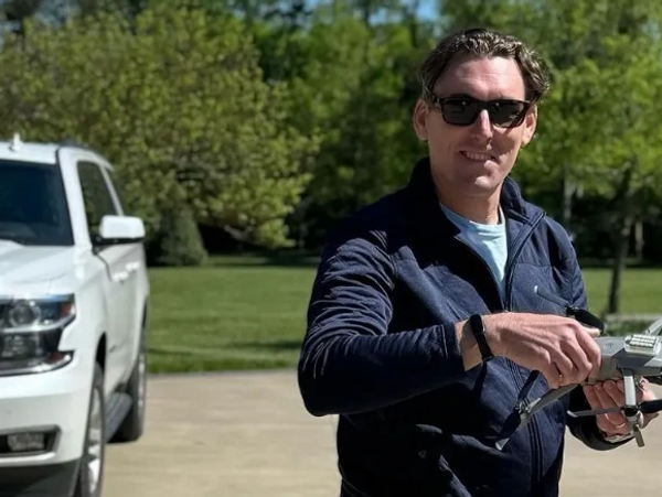
At Drone615, we are committed to offering exceptional drone imagery services. Our goal is to capture stunning visuals that enhance your projects and reflect your vision. With over 25 years of combined experience in commercial and military aviation, we lead the industry with innovation, expertise, and performance. We're the "first call" for aerial project management. Check out Seth's Xraised interview on Spotify and Amazon Music!
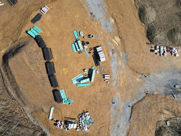
Drone615 provides aerial-derived topographic models and media-ready photo and video packages for a wide variety of applications, clients, and industries. Discover how we can help elevate your business.
We support B2B clients across commercial, industrial, government, and agricultural sectors with professional imagery and data collection. We use cutting-edge technology and data-safe sharing platforms to deliver worry-free, professional results. Each project is unique, and our uniqueness separates us from the competition.
The U.S. commercial drone market is a multi-billion-dollar industry driven by rapid advancements in automation enabled by artificial intelligence (AI), machine learning (ML), and neural network integration (Drone Industry Insights). Drone615 harnesses tools and equipment to remain competitive within the ever-changing environment of small uncrewed aerial systems (sUAS).
We stay current with state (TDOT) and federal (FAA) regulatory changes, integrations, and new products, so you don't have to. Drone615 pilots employ the highest safety standards, risk assessment, and industry best practices to ensure optimized and sustained imagery capture workflows.
Drone615 believes American manufacturing is vital to sustained growth and safety. We're an SBA-certified Service-Disabled, Veteran-Owned Small Business loyal to the United States' interests.

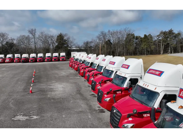
Single project, multi-site, time-phased, photo/video
imagery in 4K HD resolution for Industry:

Real-time data sharing via aerial and cloud-based
platforms providing immediate decision-making:

Drone615 offers professional media-ready photography and videography packages for commercial content creation. We provide aerial overhead shots and ground-based filming, along with expertly edited products for social media, websites, digital platforms, print, and marketing campaigns. Custom deliverables are tailored to your project using high-resolution cameras with skilled, easy-to-work-with video engineers. We deliver both qualitative and quantitative value through a comprehensive approach to aerial project management.
We believe community feedback is essential to the acceptance of technology, especially automated technologies such as drones and autonomous aerial vehicles. The growing demand for autonomous technology drives us to stay hyper-local, focusing on community engagement to educate, advocate, and mobilize around autonomous-technology initiatives and goals. We collaborate closely with local, state, and federal government offices, agencies, private companies, and non-profit organizations to raise awareness about the latest trends in multi-domain autonomous implementation.
Contact us to schedule your next event with a subject-matter expert knowledgeable in autonomous integration concepts and methodologies.
While industry-wide safety standards and best practices develop within the nascent commercial drone services space, Drone615 became the first state-wide Trusted Operator Program (TOP)-certified entity by the Association for Uncrewed Vehicle Systems International (AUVSI) in collaboration with the National Institute of Standards and Technology (NIST). Our safety record is unblemished, and we do everything we can to keep it that way.
Certifications are important, and we place equal value on our extensive network and working knowledge of FAA operations, local regulations, and relationships with local businesses and municipalities. Networking is key.


.png/:/rs=w:370,cg:true,m)


Have a question about the services we provide? Let us know! We are located just south of Nashville, TN, serving Middle Tennessee and beyond.
Drone615 is a SBA-certified Service-Disabled Veteran-Owned Small Business serving Middle Tennessee. Patriot proud, locally trusted.
- Seth "Custer" Ford
P.O. Box 55, 4817 Murfreesboro Road, Arrington, Tennessee, 37014, United States (Central Time)
Today | Closed |
